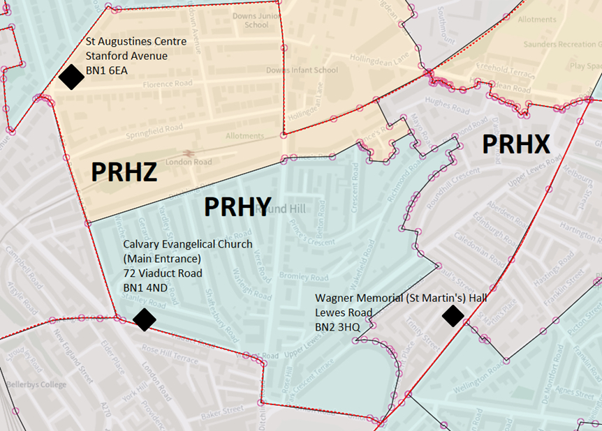
Round Hill Ward Map
Click here or on the map above to enlarge.
Note that the Round Hill ward map (for the Brighton Pavilion Parliamentary constituency) is a much larger area than the Round Hill conservation area.
The letter combinations (PRHY, PRHZ, etc.) are not abbreviations in the usual sense—they’re electoral polling district codes used by Brighton & Hove City Council for administering elections.
What the codes mean
Each code is structured systematically:
P = Parliamentary constituency (here, Brighton Pavilion)
R = Ward (in this case, Round Hill)
H / X / Y / Z = Specific polling district subdivisions within that ward
The ward map has the polling stations attached. The ward runs up to Grantham Road in the north with Ditchling Road acting as a boundary in the north part. So Downs Junior is in Round Hill but not the infants school.
Following a local government boundary review in Brighton and Hove which came into effect in May 2023, the Brighton Pavilion constituency now comprises the following from the 2024 general election: Coldean & Stanmer (majority); Hanover & Elm Grove (most – see above); Hollingdean & Fiveways; Moulsecoomb & Bevendean (small part); Patcham & Hollingbury; Preston Park; Regency (nearly all); Round Hill; West Hill & North Laine; Westdene & Hove Park (part).
This page was last updated by Ted on 22-May-2026